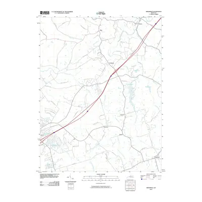
2010 Map of Smithfield
USGS Topo · Published 2010About this map
Smithfield sits at the southeastern edge of this landscape, characterized by the winding tributaries of the Little Kentucky River and the undulating terrain near Rose Hill. By 2010, the area displays a mix of traditional crossroads settlements like Sligo and Jericho alongside established water features such as Lake-Jericho and Baxter Lake. The map reveals a transition in land use, where older rural networks like Ballard School Rd and Fort Pickens Rd connect to newer developments. Local history is anchored by the Hendronsville Cemetery and Valley Rest Cemetery, which provide points of continuity in a region defined by its creeks, including Harrods Creek and the North Fork Floyds Fork. This survey documents the layout of established hamlets like Pendleton and Sulphur as they integrated with the contemporary transportation corridors of the twenty-first century.
Find a feature on this map
67 named features on this map. Tap any name to fly to it.
Don’t see what you’re looking for? This feature index may not catch every label — zoom into the map to look around manually.
Map Details
Editions of this 2010 Smithfield Map
This is the sole edition of this map. No revisions or reprints were ever made.
Other maps of this area

1928 · New Castle
USGS Topo · 1:48,000

1932 · New Castle
USGS Topo · 1:62,500

1932 · La Grange
USGS Topo · 1:62,500

1939 · Bethlehem
USGS Topo · 1:24,000

1948 · Bethlehem
USGS Topo · 1:24,000

1951 · Crestwood
USGS Topo · 1:24,000

1952 · Campbellsburg
USGS Topo · 1:24,000

1953 · Bedford
USGS Topo · 1:24,000

1953 · Bethlehem
USGS Topo · 1:24,000

1954 · Ballardsville
USGS Topo · 1:24,000