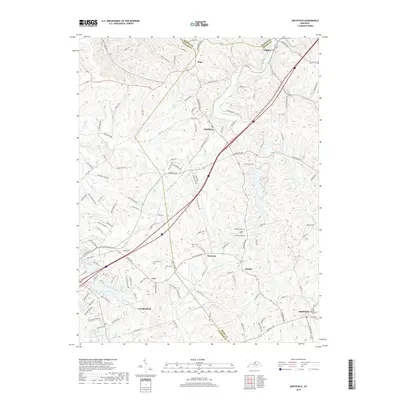
2019 Map of Smithfield
USGS Topo · Published 2019About this map
The rolling landscape of Oldham and Henry counties is defined by the headwaters of the Little Kentucky River and the agricultural corridors surrounding La Grange. Settled communities such as Smithfield, Pendleton, and Sligo anchor a network of rural roads that trace the undulating terrain between Harrods Cr and Jericho Fork. This 2019 survey documents a region where legacy family landmarks persist alongside modern thoroughfares, illustrated by several small burial grounds like Hendronsville Cem and Kerlin Cem. To the northeast, the settlement of Sulphur sits near the crossing of the Little Kentucky River, while to the southwest, the residential developments near Crystal Lake and Land N Lake show the growth expanding from the La Grange area. The map provides a precise view of the local drainage patterns, including N Fork Floyds Fork and Ash Run, which have shaped the placement of farms and small hamlets like Tarascon and Jericho.
Find a feature on this map
127 named features on this map. Tap any name to fly to it.
Don’t see what you’re looking for? This feature index may not catch every label — zoom into the map to look around manually.
Map Details
Editions of this 2019 Smithfield Map
This is the sole edition of this map. No revisions or reprints were ever made.
Other maps of this area

1928 · New Castle
USGS Topo · 1:48,000

1932 · New Castle
USGS Topo · 1:62,500

1932 · La Grange
USGS Topo · 1:62,500

1939 · Bethlehem
USGS Topo · 1:24,000

1948 · Bethlehem
USGS Topo · 1:24,000

1951 · Crestwood
USGS Topo · 1:24,000

1952 · Campbellsburg
USGS Topo · 1:24,000

1953 · Bedford
USGS Topo · 1:24,000

1953 · Bethlehem
USGS Topo · 1:24,000

1954 · Ballardsville
USGS Topo · 1:24,000