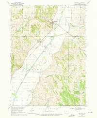
1969 Map of Smithland
USGS Topo · Published 1971About this map
The Little Sioux River valley dominates this western Iowa landscape, where the river winds southward through a complex network of bluffs and hollows. The settlement of Smithland sits at the northern end of this corridor, situated where the river makes a sharp bend near Smoky Hollow and Cottonwood Hollow. Downstream, the Chicago Milwaukee St Paul and Pacific Railroad provides a critical industrial link through the valley floor, connecting the smaller hamlets of Rodney and Ticonic. This 1960s survey documents a deeply agricultural region defined by its drainage patterns, from Parnell Creek in the northeast to Barber Creek and McMaster Creek. Genealogists will find notable value in the precisely marked locations of Smithland Cem, Hollister Cem, and Grant Cem, while the inclusion of the Maynard Landing Strip and an Old Railroad Grade offers evidence of shifting transportation priorities in the mid-20th century.
Find a feature on this map
26 named features on this map. Tap any name to fly to it.
Don’t see what you’re looking for? This feature index may not catch every label — zoom into the map to look around manually.
Map Details
Editions of this 1969 Smithland Map
This is the sole edition of this map. No revisions or reprints were ever made.
Other maps of this area

1954 · Fort Dodge
USGS Topo · 1:250,000

1955 · Sioux City
USGS Topo · 1:250,000

1957 · Fort Dodge
USGS Topo · 1:250,000

1958 · Sioux City
USGS Topo · 1:250,000

1958 · Fort Dodge
USGS Topo · 1:250,000

1959 · Sioux City
USGS Topo · 1:250,000

1964 · Climbing Hill
USGS Topo · 1:24,000

1969 · Mapleton
USGS Topo · 1:24,000

1969 · Castana
USGS Topo · 1:24,000

1969 · Onawa
USGS Topo · 1:24,000