
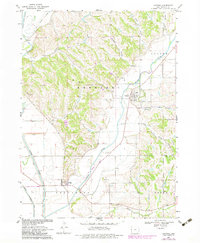
1969 Map of Castana
USGS Topo · Published 1971About this map
The confluence of the Little Sioux River and Maple River valleys defines the topography of this Monona County region at the end of the 1960s. The settlement of Castana sits on the eastern edge of the Maple River bottomlands, while Turin is positioned to the southwest near a prominent landing strip. This period shows the heavy reliance on the Chicago and North Western rail line, which cuts diagonally through the townships of Kennebec and Center.
Find a feature on this map
28 named features on this map. Tap any name to fly to it.
Don’t see what you’re looking for? This feature index may not catch every label — zoom into the map to look around manually.
Map Details
Editions of this 1969 Castana Map
2 editions found
Other maps of this area

1954 · Omaha
USGS Topo · 1:250,000

1954 · Fort Dodge
USGS Topo · 1:250,000

1955 · Sioux City
USGS Topo · 1:250,000

1955 · Fremont
USGS Topo · 1:250,000

1957 · Fremont
USGS Topo · 1:250,000

1957 · Omaha
USGS Topo · 1:250,000

1957 · Fort Dodge
USGS Topo · 1:250,000

1958 · Sioux City
USGS Topo · 1:250,000

1958 · Omaha
USGS Topo · 1:250,000

1958 · Fremont
USGS Topo · 1:250,000