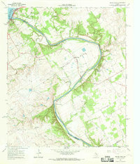
1966 Map of Smiths Bend
USGS Topo · Published 1969About this map
Brazos River meanders through the heart of this landscape, carving a deep horseshoe bend defined by the dramatic Chalk Bluff on its eastern bank. The terrain reflects a transition from the controlled waters of Lake Whitney and the Whitney Dam in the northwest to the rugged, creek-carved uplands of Greenock and Smiths Bend. This mid-1960s survey captures the region's rural character, where small settlements like Lebanon are anchored by long-standing community landmarks such as Lebanon Cem and Smiths Bend-Coon Creek Cem.
Find a feature on this map
31 named features on this map. Tap any name to fly to it.
Don’t see what you’re looking for? This feature index may not catch every label — zoom into the map to look around manually.
Map Details
Editions of this 1966 Smiths Bend Map
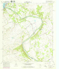
2 editions found
Other maps of this area

1892 · Waco
USGS Topo · 1:125,000

1920 · Waco
USGS Topo · 1:125,000

1924 · Waco 2-b
USGS Topo · 1:48,000

1931 · Whitney
USGS Topo · 1:62,500

1931 · Valley Mills
USGS Topo · 1:62,500

1931 · Elm Mott
USGS Topo · 1:62,500

1954 · Waco
USGS Topo · 1:250,000

1955 · Waco
USGS Topo · 1:250,000
1957 · Aquilla
USGS Topo · 1:24,000
1957 · Peoria
USGS Topo · 1:24,000