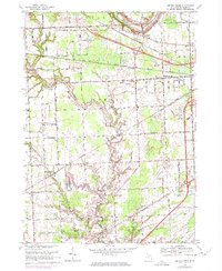
1968 Map of Smiths Creek
USGS Topo · Published 1974About this map
The Black River and Pine River carve through the glacial landscape of eastern Michigan, framing a region defined by its complex drainage network and mid-century transportation corridors. In this 1968 survey, the area around Smiths Creek and Kimball shows a transition from the wooded conservation of the Port Huron State Game Area in the north to the industrializing outskirts of Port Huron in the east. The landscape is crisscrossed by an extensive system of man-made waterways, including the Slaght Drain, Mallory Drain, and Lapeer Drain, which were essential for managing the low-lying terrain. The intersection of the Grand Trunk Western and the Chesapeake And Ohio railroads highlights the historical importance of rail transport to these small communities. Settlements like Sparlingville show emerging residential growth, supported by the Sparlingville Sch and several local churches such as the Bethlehem Saving Temple.
Find a feature on this map
62 named features on this map. Tap any name to fly to it.
Don’t see what you’re looking for? This feature index may not catch every label — zoom into the map to look around manually.
Map Details
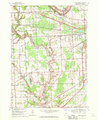
Editions of this 1968 Smiths Creek Map
2 editions found
Other maps of this area

1912 · Port Huron
USGS Topo · 1:62,500

1928 · Hicky
USGS Topo · 1:62,500

1929 · Port Huron
USGS Topo · 1:62,500

1936 · St. Clair
USGS Topo · 1:31,680

1936 · Rattle Run
USGS Topo · 1:31,680

1939 · Adair
USGS Topo · 1:24,000

1939 · Port Huron
USGS Topo · 1:24,000

1939 · St. Clair
USGS Topo · 1:24,000

1939 · Smiths Creek
USGS Topo · 1:24,000

1939 · Goodells
USGS Topo · 1:24,000