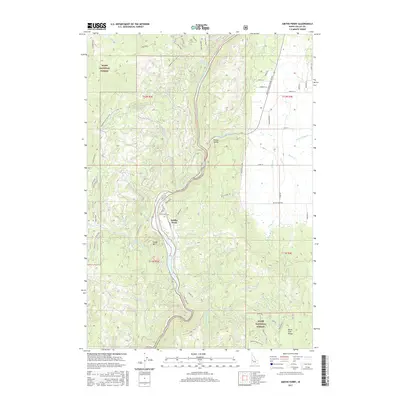
2017 Map of Smiths Ferry
USGS Topo · Published 2017About this map
The North Fork Payette River serves as the central artery for this high-altitude landscape, carving a deep valley that dictates the local transportation and settlement patterns. Along its banks, the community of Smiths Ferry and the open meadows of Round Valley provide focal points for human activity amidst the expansive Boise National Forest. The geography is defined by significant elevations, including Cougar Mtn and the North Fork Range, which hem in the river corridor. Water management and drainage are visible through features like the Tripod Reservoir and numerous named tributaries such as Boulder Cr and Round Valley Cr. The road network, including the Payette River Scenic Byway and Packer John Rd, follows the natural contours of the land, illustrating how the terrain of the North Fork Range continues to shape transit through this part of Idaho.
Find a feature on this map
48 named features on this map. Tap any name to fly to it.
Don’t see what you’re looking for? This feature index may not catch every label — zoom into the map to look around manually.
Map Details
Editions of this 2017 Smiths Ferry Map
This is the sole edition of this map. No revisions or reprints were ever made.
Other maps of this area

1894 · Squaw Creek
USGS Topo · 1:125,000

1909 · Garden Valley
USGS Topo · 1:125,000

1953 · Smiths Ferry
USGS Topo · 1:62,500

1953 · Boiling Springs
USGS Topo · 1:62,500

1953 · Banks
USGS Topo · 1:62,500

1955 · Baker
USGS Topo · 1:250,000

1957 · Challis
USGS Topo · 1:250,000

1959 · Baker
USGS Topo · 1:250,000

1959 · Garden Valley
USGS Topo · 1:62,500

1960 · Challis
USGS Topo · 1:250,000