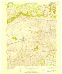
1954 Map of Smiths Grove
USGS Topo · Published 1956About this map
The Knobs dominate the northern terrain of this mid-century survey, creating a dramatic topographical transition near the border of Mammoth Cave National Park. The local economy of the 1950s is anchored by the Louisville and Nashville railroad, which runs through the heart of Smiths Grove and Oakland. This corridor is mirrored by the legendary Dixie Highway and the Blue Star Memorial Highway, illustrating the region's importance as a transportation junction between Edmonson, Warren, and Barren counties.
Find a feature on this map
33 named features on this map. Tap any name to fly to it.
Don’t see what you’re looking for? This feature index may not catch every label — zoom into the map to look around manually.
Map Details
Editions of this 1954 Smiths Grove Map
This is the sole edition of this map. No revisions or reprints were ever made.
Other maps of this area

1921 · Bowling Green
USGS Topo · 1:62,500

1922 · Brownsville
USGS Topo · 1:62,500

1922 · Mammoth Cave
USGS Topo · 1:62,500

1923 · Bowling Green
USGS Topo · 1:62,500

1923 · Mammoth Cave
USGS Topo · 1:62,500

1923 · Brownsville
USGS Topo · 1:62,500

1926 · Scottsville
USGS Topo · 1:62,500

1954 · Evansville
USGS Topo · 1:250,000

1954 · Bristow
USGS Topo · 1:24,000
1954 · Brownsville
USGS Topo · 1:24,000