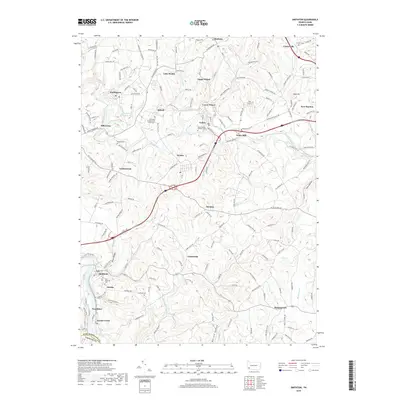
2019 Map of Smithton
USGS Topo · Published 2019About this map
The Youghiogheny River carves through the southwestern corner of this Westmoreland County landscape, passing the borough of Smithton and the riverside settlements of Eureka and Jacobs Creek. Further north, Sewickley Creek winds past Mill Grove, Yukon, and Waltz Mill, anchoring a network of small mining and residential communities. This contemporary survey preserves the locations of several important ancestral sites, including Sewickley Presbyterian Church Cem and Seven Dolors Catholic Cem, alongside family-named burial grounds like Errett Cem and Markle Cem. The area’s geography is defined by its industrial and social hubs, from the larger junctions at New Stanton and Madison to the smaller residential clusters of Upper Whyel and Lower Whyel. Between these settlements, the land is marked by named hollows like Dutch Hollow and Morrow Hollow, illustrating the deeply dissected terrain typical of the region's river valleys.
Find a feature on this map
181 named features on this map. Tap any name to fly to it.
Don’t see what you’re looking for? This feature index may not catch every label — zoom into the map to look around manually.
Map Details
Editions of this 2019 Smithton Map
This is the sole edition of this map. No revisions or reprints were ever made.
Other maps of this area

1902 · Brownsville
USGS Topo · 1:62,500

1902 · Connellsville
USGS Topo · 1:62,500

1904 · Mc Keesport
USGS Topo · 1:62,500

1904 · Greensburg
USGS Topo · 1:62,500

1906 · Brownsville
USGS Topo · 1:62,500

1906 · Greensburg
USGS Topo · 1:62,500

1907 · Pittsburg
USGS Topo · 1:62,500

1931 · Brownsville
USGS Topo · 1:62,500

1931 · Connellsville
USGS Topo · 1:62,500

1933 · Brownsville
USGS Topo · 1:62,500