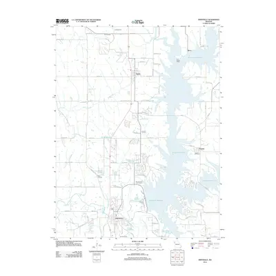
2012 Map of Smithville
USGS Topo · Published 2012About this map
The Smithville Reservoir dominates this landscape north of Kansas City, its intricate shoreline surrounding established settlements like Paradise and Trimble. This 2012 survey illustrates the transformation of the Little Platte River valley into a major recreation and water management system, while preserving traces of the area's rural history. Several small family and community burial grounds, including Reed Cemetery and Gaus Cemetery, are scattered across the terrain, serving as vital landmarks for genealogists and local historians. To the south, the city of Smithville serves as the hub of the region, featuring Helvey Park Lake and the Brooks Cemetery. The presence of the Norman Fann Farm Airport and private water bodies like JC Ranch Lake and Lake Wahoo Waters reflects the diverse land use of this Missouri corridor during the early 21st century.
Find a feature on this map
62 named features on this map. Tap any name to fly to it.
Don’t see what you’re looking for? This feature index may not catch every label — zoom into the map to look around manually.
Map Details
Editions of this 2012 Smithville Map
This is the sole edition of this map. No revisions or reprints were ever made.
Other maps of this area

1890 · Kansas City
USGS Topo · 1:125,000

1894 · Kansas City
USGS Topo · 1:125,000

1894 · Independence
USGS Topo · 1:125,000

1914 · Smithville
USGS Topo · 1:62,500

1925 · Gower
USGS Topo · 1:62,500

1925 · Plattsburg
USGS Topo · 1:62,500

1936 · Kearney
USGS Topo · 1:48,000

1942 · Kearney
USGS Topo · 1:62,500

1945 · Kearney
USGS Topo · 1:62,500
1948 · Nashua
USGS Topo · 1:24,000