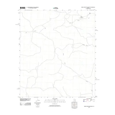
2010 Map of Smoky Mountain Ranch
USGS Topo · Published 2010About this map
Smoky Mountain Ranch defines the character of this West Texas landscape in the early 21st century. Situated in the arid reach of Pecos County, the map details the infrastructure of high-desert ranching, including the Smoky Mountain Ranch Airport and a network of unimproved roads and 4WD tracks. The drainage patterns of the region are clearly delineated, with the winding paths of Lower Fourmile Draw and Sheffield Draw illustrating how water moves through this part of the Trans-Pecos. These ephemeral watercourses and the dramatic descent of Surveyor Canyon show a terrain where topography is shaped by seasonal runoff rather than permanent flows.
Find a feature on this map
5 named features on this map. Tap any name to fly to it.
Don’t see what you’re looking for? This feature index may not catch every label — zoom into the map to look around manually.
Map Details
Editions of this 2010 Smoky Mountain Ranch Map
This is the sole edition of this map. No revisions or reprints were ever made.
Other maps of this area

1929 · Sheffield
USGS Topo · 1:125,000

1929 · Independence Draw Quadrangle
USGS Topo · 1:125,000

1954 · Fort Stockton
USGS Topo · 1:250,000

1954 · Sonora
USGS Topo · 1:250,000

1958 · Sonora
USGS Topo · 1:250,000

1958 · Fort Stockton
USGS Topo · 1:250,000

1967 · Divide Country
USGS Topo · 1:24,000

1967 · Sheffield NW
USGS Topo · 1:24,000

1967 · Horsehead Canyon
USGS Topo · 1:24,000
1969 · Smoky Mountain Ranch
USGS Topo · 1:24,000