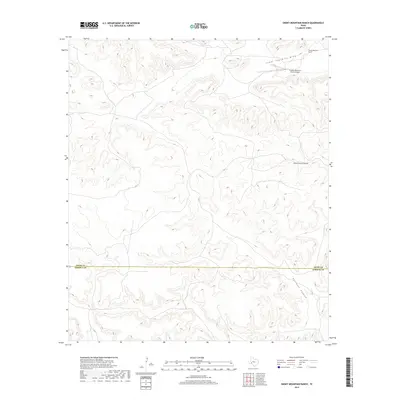
2019 Map of Smoky Mountain Ranch
USGS Topo · Published 2019About this map
Smoky Mountain Ranch sits in a high, arid landscape defined by deep ephemeral drainage systems and working ranchlands along the Trans-Pecos frontier. This topographic study reveals the sparse infrastructure typical of large-scale Texas landholdings, featuring the Smokey Mountain Ranch Airport as a primary point of access for this isolated territory. The terrain is deeply incised by the Lower Fourmile Draw and Sheffield Draw, which channel seasonal runoff toward the Pecos River basin. A significant political boundary is also documented here, as the line between Pecos County and Terrell County bisects the southern reaches of the map near Surveyor Canyon. This 2019 data illustrates the modern persistence of traditional ranching operations in one of the most sparsely populated regions of the state.
Find a feature on this map
6 named features on this map. Tap any name to fly to it.
Don’t see what you’re looking for? This feature index may not catch every label — zoom into the map to look around manually.
Map Details
Editions of this 2019 Smoky Mountain Ranch Map
This is the sole edition of this map. No revisions or reprints were ever made.
Other maps of this area

1929 · Sheffield
USGS Topo · 1:125,000

1929 · Independence Draw Quadrangle
USGS Topo · 1:125,000

1954 · Fort Stockton
USGS Topo · 1:250,000

1954 · Sonora
USGS Topo · 1:250,000

1958 · Sonora
USGS Topo · 1:250,000

1958 · Fort Stockton
USGS Topo · 1:250,000

1967 · Divide Country
USGS Topo · 1:24,000

1967 · Sheffield NW
USGS Topo · 1:24,000

1967 · Horsehead Canyon
USGS Topo · 1:24,000
1969 · Smoky Mountain Ranch
USGS Topo · 1:24,000