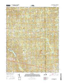
2016 Map of Smoky Ordinary
USGS Topo · Published 2016About this map
Smoky Ordinary and the surrounding coastal plain of southern Virginia are defined by a network of slow-moving waterways and historical road junctions. This 2016 survey shows the transition from the Brunswick to Greensville county line, where local life centers on small settlements like Callaville and Adsit. The landscape is heavily dissected by drainage systems including Sturgeon Creek, Cooks Branch, and the extensive Moores Swamp to the east.
Find a feature on this map
53 named features on this map. Tap any name to fly to it.
Don’t see what you’re looking for? This feature index may not catch every label — zoom into the map to look around manually.
Map Details
Editions of this 2016 Smoky Ordinary Map
This is the sole edition of this map. No revisions or reprints were ever made.
Other maps of this area

1918 · Lawrenceville
USGS Topo · 1:62,500

1919 · Mc Kenney
USGS Topo · 1:48,000

1919 · White Plains
USGS Topo · 1:48,000

1919 · Emporia
USGS Topo · 1:62,500

1920 · Lawrenceville
USGS Topo · 1:48,000

1920 · White Plains
USGS Topo · 1:62,500

1921 · Mc Kenney
USGS Topo · 1:62,500

1921 · Lawrenceville
USGS Topo · 1:62,500

1942 · Lawrenceville
USGS Topo · 1:62,500

1942 · Emporia
USGS Topo · 1:62,500