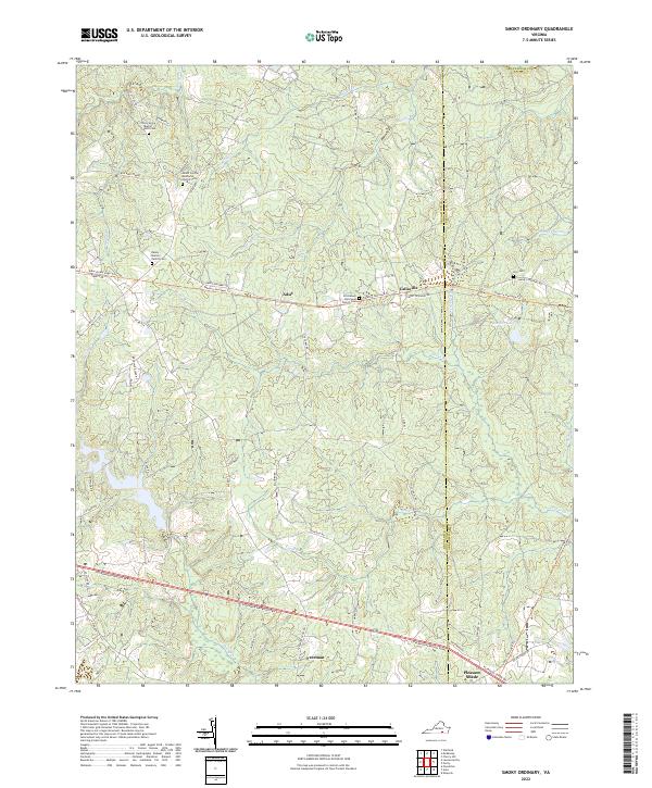
2022 Map of Smoky Ordinary
USGS Topo · Published 2022About this map
Sturgeon Creek and Indian Cr carve through this central Brunswick County landscape, where rural life is anchored by traditional crossroads and family landmarks. The map documents long-standing community centers like Piney Grove Baptist Church Cem and the Mount Carmel Methodist Church Cem in the north, alongside the historic Emmanuel Episcopal Church Cem near Callaville. The transition from old transit routes to modern corridors is evident, as the Tobacco Heritage Trl follows an east-west path through Adsit, while the southern portion of the quadrangle is dominated by the Governor Harrison Pkwy. Genealogists can find specific family heritage at the Raney - Mallory Family Cem, while researchers of local geography can trace the small settlements of Freeman and Pleasant Shade near the Greenesville County border.
Find a feature on this map
58 named features on this map. Tap any name to fly to it.
Don’t see what you’re looking for? This feature index may not catch every label — zoom into the map to look around manually.
Map Details
Editions of this 2022 Smoky Ordinary Map
This is the sole edition of this map. No revisions or reprints were ever made.
Other maps of this area

1918 · Lawrenceville
USGS Topo · 1:62,500

1919 · Mc Kenney
USGS Topo · 1:48,000

1919 · White Plains
USGS Topo · 1:48,000

1919 · Emporia
USGS Topo · 1:62,500

1920 · Lawrenceville
USGS Topo · 1:48,000

1920 · White Plains
USGS Topo · 1:62,500

1921 · Mc Kenney
USGS Topo · 1:62,500

1921 · Lawrenceville
USGS Topo · 1:62,500

1942 · Lawrenceville
USGS Topo · 1:62,500

1942 · Emporia
USGS Topo · 1:62,500