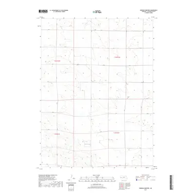
2017 Map of Smyrna Cemetery
USGS Topo · Published 2017About this map
Smyrna Cem serves as a quiet landmark within this vast section of the Nebraska Panhandle, situated near the intersection of RD 44 and RD 81. The landscape is defined by the high plains of Cheyenne County, where the seasonal waters of Rush Cr meander through the northern townships. This 2017 survey illustrates the enduring grid of the Public Land Survey System, with boundaries such as t16n r52w and t15n r53w framing a territory dedicated almost exclusively to ranching and dryland agriculture. The sparse distribution of named features emphasizes the open, rural character of the region, where a network of county roads including RD 52 and RD 36 provides the primary infrastructure connecting isolated homesteads across the tablelands.
Find a feature on this map
15 named features on this map. Tap any name to fly to it.
Don’t see what you’re looking for? This feature index may not catch every label — zoom into the map to look around manually.
Map Details
Editions of this 2017 Smyrna Cemetery Map
This is the sole edition of this map. No revisions or reprints were ever made.
Other maps of this area

1954 · Scottsbluff
USGS Topo · 1:250,000

1958 · Scottsbluff
USGS Topo · 1:250,000

1972 · Mud Springs SW
USGS Topo · 1:24,000

1972 · Dix
USGS Topo · 1:24,000

1972 · Point Of Rocks
USGS Topo · 1:24,000

1972 · Horsehead Ranch
USGS Topo · 1:24,000

1972 · Potter
USGS Topo · 1:24,000

1973 · Potter 2 SW
USGS Topo · 1:24,000

1973 · Potter 2 SE
USGS Topo · 1:24,000

1973 · Potter 2 NW
USGS Topo · 1:24,000