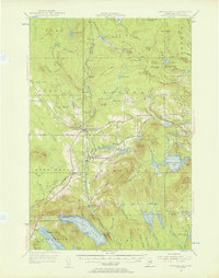
1955 Map of Smyrna Mills
USGS Topo · Published 1956About this map
Bangor and Aroostook rail lines anchor the local economy in this mid-century survey of southern Aroostook County, connecting timber and agricultural hubs like Smyrna Mills and Oakfield. The landscape is a network of ridges and water bodies, including Emerson Ridge and the expansive Meduxnekeag Lake. Settlement patterns follow the rail corridor and the Aroostook River, with smaller outposts like Walker Settlement and Emerson Siding serving the surrounding woods. Education was highly localized at the time, evidenced by several rural schoolhouses such as Roosevelt Sch and Huntley Mill Pd Sch. The map also reveals the importance of local water resources, with numerous ponds like Spaulding Lake and Cochrane Lake dotting the terrain between the primary rail stops and the higher elevations of Timoney Mountain and Sam Drew Mountain.
Find a feature on this map
113 named features on this map. Tap any name to fly to it.
Don’t see what you’re looking for? This feature index may not catch every label — zoom into the map to look around manually.
Map Details
Editions of this 1955 Smyrna Mills Map
4 editions found

Other maps of this area

1934 · Bridgewater
USGS Topo · 1:48,000

1935 · Howe Brook
USGS Topo · 1:48,000

1937 · Smyrna Mills
USGS Topo · 1:62,500

1938 · Bridgewater
USGS Topo · 1:62,500

1938 · Houlton
USGS Topo · 1:62,500

1939 · Howe Brook
USGS Topo · 1:62,500

1940 · Amity
USGS Topo · 1:62,500

1940 · Island Falls
USGS Topo · 1:62,500

1940 · Sherman
USGS Topo · 1:62,500

1940 · Oxbow
USGS Topo · 1:62,500