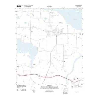
2011 Map of Sneads
USGS Topo · Published 2011About this map
Sneads sits at a strategic junction near the Florida-Georgia border, where the Chattahoochee River and Apalachee River converge to form the Lake Seminole reservoir. The town’s layout and surrounding rural settlements like Inwood and Sinai reflect a deep connection to the water and agricultural history. To the west, the expansive Ocheesee Pond and its namesake community, Ocheesee Gardens, dominate the terrain, separated from the town center by a network of local routes including Old Spanish Trl and McKeown Mill Rd.
Find a feature on this map
50 named features on this map. Tap any name to fly to it.
Don’t see what you’re looking for? This feature index may not catch every label — zoom into the map to look around manually.
Map Details
Editions of this 2011 Sneads Map
This is the sole edition of this map. No revisions or reprints were ever made.
Other maps of this area

1952 · Cypress
USGS Topo · 1:24,000

1952 · Dellwood
USGS Topo · 1:24,000

1952 · Altha East
USGS Topo · 1:24,000

1954 · Sneads
USGS Topo · 1:24,000

1954 · Tallahassee
USGS Topo · 1:250,000

1955 · Fairchild
USGS Topo · 1:24,000

1955 · Reynoldsville
USGS Topo · 1:24,000

1955 · Rock Bluff
USGS Topo · 1:24,000

1955 · Sycamore
USGS Topo · 1:24,000

1955 · Chattahoochee
USGS Topo · 1:24,000