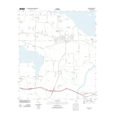
2012 Map of Sneads
USGS Topo · Published 2012About this map
The Apalachicola River defines the eastern boundary of this 2012 survey, where the Dewey M Johnson Bridge carries traffic across the water toward Gadsden County. The landscape is a mosaic of small settlements and family-named landmarks, including the residential clusters of Inwood, Ocheesee Gardens, and Sinai. Genealogists will find several burial grounds noted, such as Yon Cem, Dykes Cem, and Sinai Cem, providing important geographic anchors for local family history research.
Find a feature on this map
121 named features on this map. Tap any name to fly to it.
Don’t see what you’re looking for? This feature index may not catch every label — zoom into the map to look around manually.
Map Details
Editions of this 2012 Sneads Map
This is the sole edition of this map. No revisions or reprints were ever made.
Other maps of this area

1952 · Cypress
USGS Topo · 1:24,000

1952 · Dellwood
USGS Topo · 1:24,000

1952 · Altha East
USGS Topo · 1:24,000

1954 · Sneads
USGS Topo · 1:24,000

1954 · Tallahassee
USGS Topo · 1:250,000

1955 · Fairchild
USGS Topo · 1:24,000

1955 · Reynoldsville
USGS Topo · 1:24,000

1955 · Rock Bluff
USGS Topo · 1:24,000

1955 · Sycamore
USGS Topo · 1:24,000

1955 · Chattahoochee
USGS Topo · 1:24,000