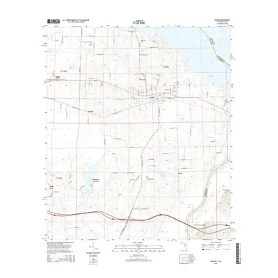
2015 Map of Sneads
USGS Topo · Published 2015About this map
The Apalachicola River forms a prominent natural boundary on the eastern edge of this Jackson County landscape, separating Florida from Georgia near the expansive Lake Seminole. The town of Sneads serves as a central hub, surrounded by smaller communities and agricultural pockets like Inwood, Sinai, and Ocheesee Gardens. The terrain is marked by numerous water bodies and wetlands, including Ham Pond, July Lake, and Shelfer Bay, alongside industrial vestiges such as Brickyard Pond. For those researching local families, the map documents several distinct burial grounds including Dykes Cem, Pope Cem, and Yon Cem, while the Kilpatrick Farm Airport highlights the region's rural aviation footprint. Transport and logistics are defined by the corridor connecting Grand Ridge to the river, crossing the Dewey M Johnson Bridge into Gadsden County.
Find a feature on this map
110 named features on this map. Tap any name to fly to it.
Don’t see what you’re looking for? This feature index may not catch every label — zoom into the map to look around manually.
Map Details
Editions of this 2015 Sneads Map
This is the sole edition of this map. No revisions or reprints were ever made.
Other maps of this area

1952 · Cypress
USGS Topo · 1:24,000

1952 · Dellwood
USGS Topo · 1:24,000

1952 · Altha East
USGS Topo · 1:24,000

1954 · Sneads
USGS Topo · 1:24,000

1954 · Tallahassee
USGS Topo · 1:250,000

1955 · Fairchild
USGS Topo · 1:24,000

1955 · Reynoldsville
USGS Topo · 1:24,000

1955 · Rock Bluff
USGS Topo · 1:24,000

1955 · Sycamore
USGS Topo · 1:24,000

1955 · Chattahoochee
USGS Topo · 1:24,000