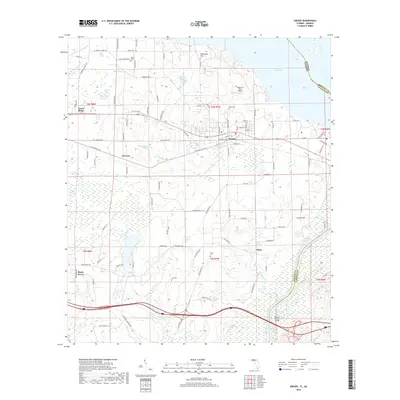
2018 Map of Sneads
USGS Topo · Published 2018About this map
Sneads anchors this panhandle landscape where the eastern edge of Jackson County meets the Apalachicola River and the expansive waters of Lake Seminole. The geography is defined by a dense network of local ponds and bays, including Shelfer Bay, Sugar Mill Pond, and Ham Pond, reflecting the complex hydrology of the region. Transportation routes like the Old Spanish Trl and various family-named roads such as Dykes Cemetery Rd provide a clear view of the settlement patterns between the small hubs of Grand Ridge and Sinai.
Find a feature on this map
114 named features on this map. Tap any name to fly to it.
Don’t see what you’re looking for? This feature index may not catch every label — zoom into the map to look around manually.
Map Details
Editions of this 2018 Sneads Map
This is the sole edition of this map. No revisions or reprints were ever made.
Other maps of this area

1952 · Cypress
USGS Topo · 1:24,000

1952 · Dellwood
USGS Topo · 1:24,000

1952 · Altha East
USGS Topo · 1:24,000

1954 · Sneads
USGS Topo · 1:24,000

1954 · Tallahassee
USGS Topo · 1:250,000

1955 · Fairchild
USGS Topo · 1:24,000

1955 · Reynoldsville
USGS Topo · 1:24,000

1955 · Rock Bluff
USGS Topo · 1:24,000

1955 · Sycamore
USGS Topo · 1:24,000

1955 · Chattahoochee
USGS Topo · 1:24,000