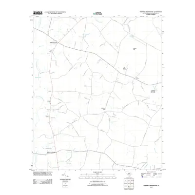
2011 Map of Sniders Crossroads
USGS Topo · Published 2011About this map
Sniders Crossroads and Bells Crossroads anchor this Colleton County landscape, where the Little Salkehatchie River and its tributaries define the low-lying terrain. The area is characterized by a high concentration of small family and community burial grounds, including the Old Field Creek Cemetery, Bethel Cemetery, and the John Herndon Cemetery. These sites, along with others like the Breland Cemetery and Ulmer Cemetery, offer a significant window into the settlement patterns and genealogy of the coastal plain during the early 21st century.
Find a feature on this map
79 named features on this map. Tap any name to fly to it.
Don’t see what you’re looking for? This feature index may not catch every label — zoom into the map to look around manually.
Map Details
Editions of this 2011 Sniders Crossroads Map
This is the sole edition of this map. No revisions or reprints were ever made.
Other maps of this area

1918 · Walterboro
USGS Topo · 1:62,500

1919 · Cummings
USGS Topo · 1:62,500

1919 · Lodge
USGS Topo · 1:62,500

1920 · Lodge
USGS Topo · 1:48,000

1920 · St. George
USGS Topo · 1:48,000

1921 · Lodge
USGS Topo · 1:62,500

1921 · St. George
USGS Topo · 1:62,500

1943 · Lodge
USGS Topo · 1:62,500

1943 · Orangeburg
USGS Topo · 1:125,000

1943 · Cummings
USGS Topo · 1:62,500