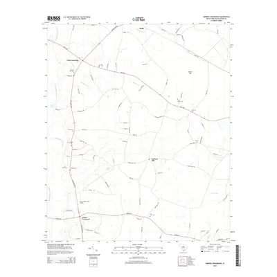
2014 Map of Sniders Crossroads
USGS Topo · Published 2014About this map
Sniders Crossroads and Bells Crossroads serve as the primary hubs for this rural Colleton County landscape, where the Lowcountry HWY and Bells HWY intersect. The western edge is defined by the winding course of the Little Salkehatchie River, which feeds into wetlands like Bryans Lake. This area is particularly rich for genealogical research, documenting numerous family and community burial grounds including Old Field Creek Cem, Breland Cem, and the John Herndon Cem. Evidence of the region’s aviation and industrial history appears at the Hannah Rhea Field Airport and the site of Hudsons Mill. Away from the main highways, the terrain is characterized by broad basins such as Parkers Bay and numerous small watercourses like Oldfield Creek and Deep Bottom Cr, which drain the low-lying coastal plain between Ruffin and the surrounding timberlands.
Find a feature on this map
81 named features on this map. Tap any name to fly to it.
Don’t see what you’re looking for? This feature index may not catch every label — zoom into the map to look around manually.
Map Details
Editions of this 2014 Sniders Crossroads Map
This is the sole edition of this map. No revisions or reprints were ever made.
Other maps of this area

1918 · Walterboro
USGS Topo · 1:62,500

1919 · Cummings
USGS Topo · 1:62,500

1919 · Lodge
USGS Topo · 1:62,500

1920 · Lodge
USGS Topo · 1:48,000

1920 · St. George
USGS Topo · 1:48,000

1921 · Lodge
USGS Topo · 1:62,500

1921 · St. George
USGS Topo · 1:62,500

1943 · Lodge
USGS Topo · 1:62,500

1943 · Orangeburg
USGS Topo · 1:125,000

1943 · Cummings
USGS Topo · 1:62,500