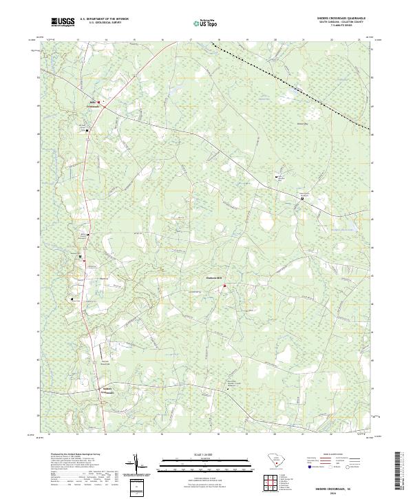
2024 Map of Sniders Crossroads
USGS Topo · Published 2024About this map
Sniders Crossroads and Bells Crossroads anchor this modern topographic view of rural Colleton County, where the landscape is defined by the winding course of the Little Salkehatchie River and its associated wetlands. The area is dotted with numerous small family and community burial sites, providing a wealth of information for local genealogy, including the John Herndon Cem, Ulmer Cem, and the Bethel Church Graveyard. Evidence of the region’s hydrological character is found in the many named bays, such as Deep Bottom Bay and Parkers Bay, which were historically significant for their unique ecosystem and timber potential. The road network connects small rural centers like Hudsons Mill and Hannah Rhea Field, reflecting a settlement pattern that persists around early crossroads and water-driven industry sites.
Find a feature on this map
78 named features on this map. Tap any name to fly to it.
Don’t see what you’re looking for? This feature index may not catch every label — zoom into the map to look around manually.
Map Details
Editions of this 2024 Sniders Crossroads Map
This is the sole edition of this map. No revisions or reprints were ever made.
Other maps of this area

1918 · Walterboro
USGS Topo · 1:62,500

1919 · Cummings
USGS Topo · 1:62,500

1919 · Lodge
USGS Topo · 1:62,500

1920 · Lodge
USGS Topo · 1:48,000

1920 · St. George
USGS Topo · 1:48,000

1921 · Lodge
USGS Topo · 1:62,500

1921 · St. George
USGS Topo · 1:62,500

1943 · Lodge
USGS Topo · 1:62,500

1943 · Orangeburg
USGS Topo · 1:125,000

1943 · Cummings
USGS Topo · 1:62,500