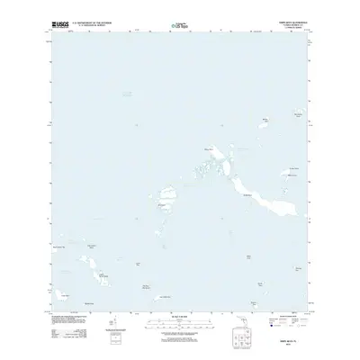
2012 Map of Snipe Keys
USGS Topo · Published 2012About this map
Snipe Keys and the surrounding labyrinth of mangroves and tidal channels represent a largely undeveloped aquatic landscape in Monroe County during the early 21st century. This 2012 survey documents the intricate geography of the Lower Keys, where deeper passages like the Jewfish Channel and Mud Key Channel separate clusters of islands. The map highlights numerous small landforms with localized names such as Old Dan Mangrove, Coon Key, and Fish Hawk Key, suggesting a history of local navigation and fishing use. The lack of roads or infrastructure emphasizes the region's character as a wilderness of the Gulf of Mexico, where travel is dictated by features like the Outer Narrows and the Barracuda Keys Channel.
Find a feature on this map
28 named features on this map. Tap any name to fly to it.
Don’t see what you’re looking for? This feature index may not catch every label — zoom into the map to look around manually.
Map Details
Editions of this 2012 Snipe Keys Map
This is the sole edition of this map. No revisions or reprints were ever made.
Other maps of this area

1921 · Sugar Loaf Key
USGS Topo · 1:62,500

1921 · Key West
USGS Topo · 1:62,500

1943 · Bay Keys
USGS Topo · 1:24,000

1943 · Saddlebunch Keys
USGS Topo · 1:24,000

1943 · Boca Chica
USGS Topo · 1:24,000

1943 · Key West
USGS Topo · 1:24,000

1943 · Snipe Keys
USGS Topo · 1:24,000

1943 · Sugarloaf Key
USGS Topo · 1:24,000

1962 · Key West
USGS Topo · 1:24,000

1968 · Saddlebunch Keys
USGS Topo · 1:24,000