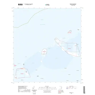
2021 Map of Snipe Keys
USGS Topo · Published 2021About this map
The Gulf of Mexico surrounds a complex network of mangroves and keys in this modern survey of Monroe County. The landscape is defined by tidal waterways and shallow basins, where the Intracoastal Waterway cuts across the northern reaches. This map illustrates the intricate geography of the backcountry, highlighting the numerous small landmasses such as the Snipe Keys, Mud Keys, and the curiously named Old Dan Mangrove.
Find a feature on this map
33 named features on this map. Tap any name to fly to it.
Don’t see what you’re looking for? This feature index may not catch every label — zoom into the map to look around manually.
Map Details
Editions of this 2021 Snipe Keys Map
This is the sole edition of this map. No revisions or reprints were ever made.
Other maps of this area

1921 · Sugar Loaf Key
USGS Topo · 1:62,500

1921 · Key West
USGS Topo · 1:62,500

1943 · Bay Keys
USGS Topo · 1:24,000

1943 · Saddlebunch Keys
USGS Topo · 1:24,000

1943 · Boca Chica
USGS Topo · 1:24,000

1943 · Key West
USGS Topo · 1:24,000

1943 · Snipe Keys
USGS Topo · 1:24,000

1943 · Sugarloaf Key
USGS Topo · 1:24,000

1962 · Key West
USGS Topo · 1:24,000

1968 · Saddlebunch Keys
USGS Topo · 1:24,000