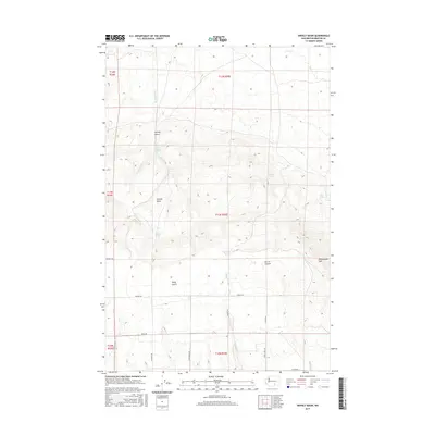
2017 Map of Snively Basin
USGS Topo · Published 2017About this map
Snively Basin dominates this landscape in Benton County, where the topography of the Horse Heaven Hills region is defined by deep draws and vital water sources. The map reveals an arid environment where water is the primary landmark, marked by a series of named springs including Upper Snively Spring, Lower Snively Spring, and Benson Spring. These perennial points were historically significant for livestock and early land use in the high desert. To the east, the elevation climbs toward the slopes of Rattlesnake Mtn, while the southern portion of the quadrangle shows a transition into a more structured agricultural layout. A network of rural roads like Bennett Rd and Pearl Rd provides access to the drainages of Corral Canyon and Kelly Gulch, tracing the natural paths carved by seasonal flows like Snipes Creek.
Find a feature on this map
30 named features on this map. Tap any name to fly to it.
Don’t see what you’re looking for? This feature index may not catch every label — zoom into the map to look around manually.
Map Details
Editions of this 2017 Snively Basin Map
This is the sole edition of this map. No revisions or reprints were ever made.
Other maps of this area

1915 · Prosser
USGS Topo · 1:125,000

1916 · Coyote Rapids
USGS Topo · 1:62,500

1917 · Priest Rapids
USGS Topo · 1:62,500

1917 · Prosser
USGS Topo · 1:125,000

1948 · Emerson Nipple
USGS Topo · 1:24,000

1950 · Grandview
USGS Topo · 1:62,500

1951 · Priest Rapids
USGS Topo · 1:62,500

1951 · Grandview
USGS Topo · 1:62,500

1951 · Corral Canyon
USGS Topo · 1:62,500

1951 · Coyote Rapids
USGS Topo · 1:62,500