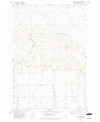
1974 Map of Snively Basin
USGS Topo · Published 1977About this map
Hanford Works dominates the northern reaches of this mid-1970s landscape, reflecting the restricted nature of the terrain during the Cold War era. The survey highlights a transitional zone between the high peaks of Rattlesnake Mountain and the lower-lying Snively Basin. While the area is marked as Restricted, the map meticulously documents the remnants of earlier habitation and resource use, including the Benson Ranch (Site) and Snively Ranch.
Find a feature on this map
42 named features on this map. Tap any name to fly to it.
Don’t see what you’re looking for? This feature index may not catch every label — zoom into the map to look around manually.
Map Details
Editions of this 1974 Snively Basin Map
This is the sole edition of this map. No revisions or reprints were ever made.
Other maps of this area

1915 · Prosser
USGS Topo · 1:125,000

1916 · Coyote Rapids
USGS Topo · 1:62,500

1917 · Priest Rapids
USGS Topo · 1:62,500

1917 · Prosser
USGS Topo · 1:125,000

1948 · Emerson Nipple
USGS Topo · 1:24,000

1950 · Grandview
USGS Topo · 1:62,500

1951 · Priest Rapids
USGS Topo · 1:62,500

1951 · Grandview
USGS Topo · 1:62,500

1951 · Corral Canyon
USGS Topo · 1:62,500

1951 · Coyote Rapids
USGS Topo · 1:62,500