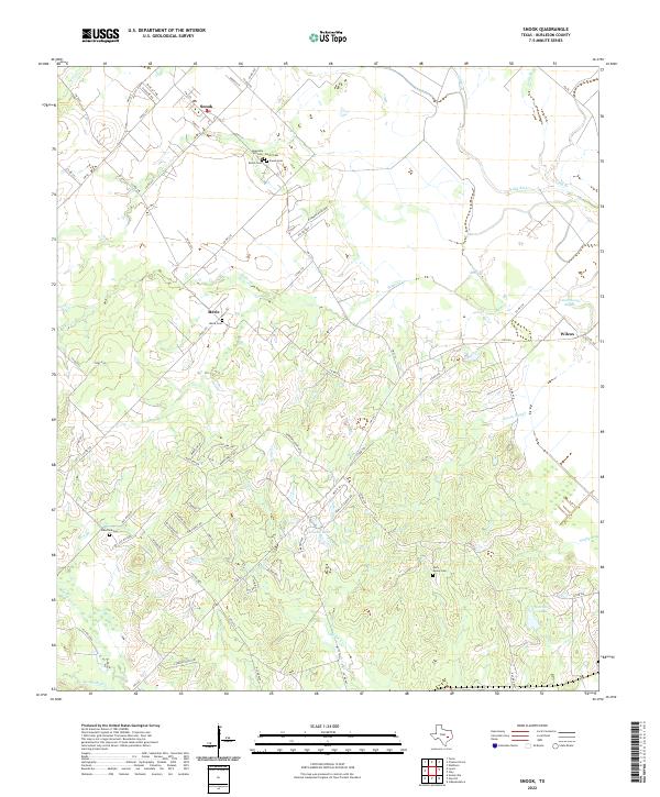
2022 Map of Snook
USGS Topo · Published 2022About this map
The settlement of Snook anchors this Burleson County landscape, where the flatlands are defined by a complex network of creeks and drainage sloughs. A remarkable concentration of family and community burial grounds, including Heavenly Hill Cem, Carvin Cem, Bettis Cem, and Snook Cem, is clustered south of the main townsite, offering a clear spatial record of early settlement patterns and genealogical history. To the south, the community of Merle sits near its namesake Merle Cem, while Wilcox is situated to the east near the banks of Old River. The terrain is characterized by meandering waterways like Bethel Cr and Bridge Cr, which feed into larger bodies such as Hutchings Lake and Schutte Lake. The presence of these named cemeteries and small rural centers provides a detailed framework for tracing local heritage in this part of Texas.
Find a feature on this map
83 named features on this map. Tap any name to fly to it.
Don’t see what you’re looking for? This feature index may not catch every label — zoom into the map to look around manually.
Map Details
Editions of this 2022 Snook Map
This is the sole edition of this map. No revisions or reprints were ever made.
Other maps of this area

1914 · Gay Hill
USGS Topo · 1:62,500

1954 · Austin
USGS Topo · 1:250,000

1956 · Bryan
USGS Topo · 1:62,500

1956 · Caldwell
USGS Topo · 1:62,500

1956 · Somerville
USGS Topo · 1:62,500

1959 · Gay Hill
USGS Topo · 1:24,000

1959 · Clay
USGS Topo · 1:24,000

1959 · Somerville
USGS Topo · 1:24,000

1959 · Independence
USGS Topo · 1:24,000

1960 · Lyons
USGS Topo · 1:24,000