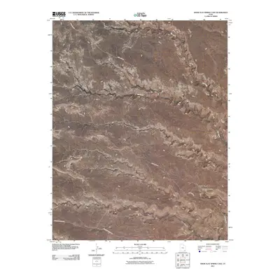
2011 Map of Snow Flat Spring Cave
USGS Topo · Published 2011About this map
Cedar Mesa dominates this corner of San Juan County, Utah, where a high-desert plateau is deeply incised by drainages like Owl Creek and Fish Creek. The landscape transition is most evident at the eastern edge of Snow Flat, where the plateau surface gives way to the winding depths of Road Canyon. This 2011 survey documents the sparse but critical network of primitive transportation routes that serve this high-elevation region, specifically Snow Flats Rd and Cigarette Springs Rd. A significant point of interest for local history and geology is Snow Flat Spring Cave, located near the terminus of the Snow Flat plateau. The map illustrates how human activity in this corner of the state remains tethered to these few improved roads and established water-related landmarks.
Find a feature on this map
9 named features on this map. Tap any name to fly to it.
Don’t see what you’re looking for? This feature index may not catch every label — zoom into the map to look around manually.
Map Details
Editions of this 2011 Snow Flat Spring Cave Map
This is the sole edition of this map. No revisions or reprints were ever made.
Other maps of this area

1886 · Abajo
USGS Topo · 1:250,000

1892 · Abajo
USGS Topo · 1:250,000

1893 · Abajo
USGS Topo · 1:250,000

1935 · Elk Ridge
USGS Topo · 1:96,000

1940 · Elk Ridge
USGS Topo · 1:125,000
1954 · Elk Ridge 3 SW
USGS Topo · 1:24,000

1954 · Elk Ridge 3 SE
USGS Topo · 1:24,000

1954 · Bears Ears
USGS Topo · 1:62,500

1956 · Cortez
USGS Topo · 1:250,000

1957 · Brushy Basin Wash
USGS Topo · 1:62,500