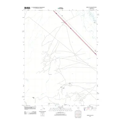
2011 Map of Snow Gulch
USGS Topo · Published 2011About this map
The Humboldt River and Reese River converge in this northern Nevada landscape, where the corridor of modern transit meets the traces of early homesteading and resource extraction. The map reveals a transition from the riparian basins to the higher terrain of Snow Gulch and Piute Canyon. Remnants of human activity are scattered throughout the drainages, including the Dewitt Mill in the southwest and family-named landmarks like Healey Cabins and Holcomb Cabin. These small-scale settlements and camps contrast with the industrial scale of the northern rail and highway corridor near Mote Siding and Russell Hay Camp. The extensive network of roads and trails crossing Elder Creek suggests a landscape defined by ranching and transit, where seasonal camps and mills served as the primary anchors in the high desert environment.
Find a feature on this map
17 named features on this map. Tap any name to fly to it.
Don’t see what you’re looking for? This feature index may not catch every label — zoom into the map to look around manually.
Map Details
Editions of this 2011 Snow Gulch Map
This is the sole edition of this map. No revisions or reprints were ever made.
Other maps of this area

1932 · Sonoma Range
USGS Topo · 1:250,000

1939 · Sonoma Range
USGS Topo · 1:250,000

1940 · Antler Peak
USGS Topo · 1:62,500

1943 · Antler Peak
USGS Topo · 1:62,500

1955 · Winnemucca
USGS Topo · 1:250,000

1957 · Battle Mountain
USGS Topo · 1:62,500

1958 · Winnemucca
USGS Topo · 1:250,000

1962 · Winnemucca
USGS Topo · 1:250,000

1965 · Russells
USGS Topo · 1:24,000
1965 · Valmy
USGS Topo · 1:24,000