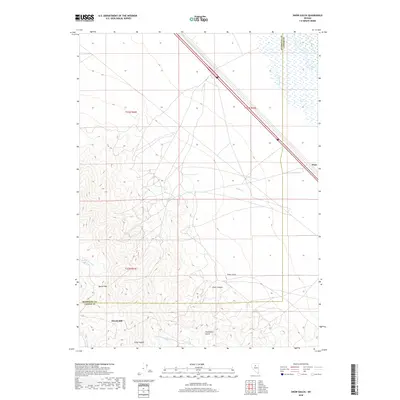
2018 Map of Snow Gulch
USGS Topo · Published 2018About this map
Dewitt Mill and the rising slopes of Battle Mtn anchor the southern portion of this landscape, where the high desert terrain of the Humboldt and Lander County line meets a complex network of seasonal drainage. The hydrology of the region is defined by the Reese River and numerous canyons, including Piute Canyon and Poormans Gulch, which channel runoff from the peaks toward the valley floor.
Find a feature on this map
17 named features on this map. Tap any name to fly to it.
Don’t see what you’re looking for? This feature index may not catch every label — zoom into the map to look around manually.
Map Details
Editions of this 2018 Snow Gulch Map
This is the sole edition of this map. No revisions or reprints were ever made.
Other maps of this area

1932 · Sonoma Range
USGS Topo · 1:250,000

1939 · Sonoma Range
USGS Topo · 1:250,000

1940 · Antler Peak
USGS Topo · 1:62,500

1943 · Antler Peak
USGS Topo · 1:62,500

1955 · Winnemucca
USGS Topo · 1:250,000

1957 · Battle Mountain
USGS Topo · 1:62,500

1958 · Winnemucca
USGS Topo · 1:250,000

1962 · Winnemucca
USGS Topo · 1:250,000

1965 · Russells
USGS Topo · 1:24,000
1965 · Valmy
USGS Topo · 1:24,000