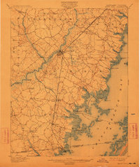
1901 Map of Snow Hill
USGS Topo · Published 1913About this map
Pocomoke River navigation and coastal rail lines define the landscape of Worcester County at the opening of the twentieth century. The town of Snow Hill serves as a central hub, where the Philadelphia Wilmington and Baltimore railroad intersects with a Steamboat Route winding through the river's bends. This intricate transport network supported local industry and trade, connecting inland landings like Mattaponi Landing and Milburn Landing to larger markets.
Find a feature on this map
84 named features on this map. Tap any name to fly to it.
Don’t see what you’re looking for? This feature index may not catch every label — zoom into the map to look around manually.
Map Details
Editions of this 1901 Snow Hill Map
4 editions found
Other maps of this area

1901 · Snow Hill
USGS Topo · 1:62,500

1901 · Salisbury
USGS Topo · 1:62,500

1901 · Green Run
USGS Topo · 1:62,500

1901 · Ocean City
USGS Topo · 1:62,500

1902 · Pittsville
USGS Topo · 1:62,500

1938 · Green Run
USGS Topo · 1:62,500

1942 · Ocean City
USGS Topo · 1:62,500

1942 · Chincoteague East
USGS Topo · 1:24,000

1942 · Ninepin
USGS Topo · 1:24,000

1942 · Snow Hill
USGS Topo · 1:24,000