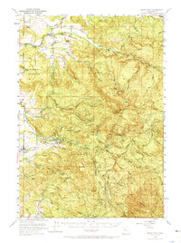
1951 Map of Snow Peak
USGS Topo · Published 1972About this map
The Willamette Meridian bisects this mid-century view of the Cascades foothills, where the industrial timber landscape and early conservation efforts are well-documented. Small valley settlements like Lacomb and Jordan sit on the western edge, giving way to a rugged interior of peaks such as Rogers Mountain, Green Mtn, and Snow Peak. The mapping of several schools and cemeteries, including the St Benedicta School Cem, East Berlin Sch, and Lacomb Cem, provides essential points of reference for local family history and genealogy.
Find a feature on this map
47 named features on this map. Tap any name to fly to it.
Don’t see what you’re looking for? This feature index may not catch every label — zoom into the map to look around manually.
Map Details
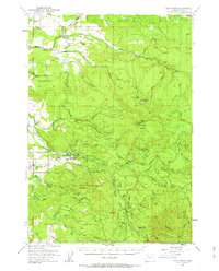
Editions of this 1951 Snow Peak Map
3 editions found

Other maps of this area

1921 · Brownsville
USGS Topo · 1:62,500

1921 · Lebanon
USGS Topo · 1:62,500

1922 · Lebanon
USGS Topo · 1:48,000

1924 · Lebanon
USGS Topo · 1:62,500

1925 · Stayton
USGS Topo · 1:62,500

1929 · Mill City
USGS Topo · 1:125,000

1934 · Mc Kenzie Bridge
USGS Topo · 1:96,000

1940 · Lebanon
USGS Topo · 1:62,500

1940 · Mc Kenzie Bridge
USGS Topo · 1:125,000

1941 · Stayton
USGS Topo · 1:62,500