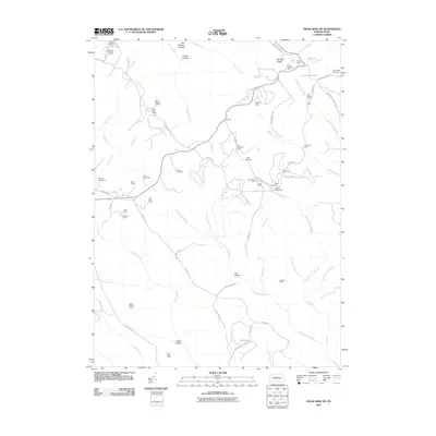
2010 Map of Snow Shoe NE
USGS Topo · Published 2010About this map
State Camp and numerous seasonal outposts define this high-elevation landscape in Clinton County. The terrain is deeply incised by the drainage networks of West Branch Big Run and Dennison Fork, creating a pattern of isolated ridges and hollows like Proctor Hollow and Owl Hollow. Historically, the area appears as a hub for hunting and forestry, as evidenced by the high concentration of named camps such as The Hemlocks Camp, Camp Chestnut Hill, and Ralphton Camp scattered throughout the woods. Infrastructure is primarily limited to forest roads and trails, including the Fisher Fire Rd and Beech Creek Mountain Rd. A prominent landmark for the region is the Coffin Rock Fire Tower, positioned on a high point to monitor the surrounding timberlands. This map records a landscape managed for conservation and recreation, where the names of small camps provide the primary points of human geography.
Find a feature on this map
76 named features on this map. Tap any name to fly to it.
Don’t see what you’re looking for? This feature index may not catch every label — zoom into the map to look around manually.
Map Details
Editions of this 2010 Snow Shoe NE Map
This is the sole edition of this map. No revisions or reprints were ever made.
Other maps of this area

1921 · Howard
USGS Topo · 1:48,000

1923 · Howard
USGS Topo · 1:62,500

1928 · Snow Shoe
USGS Topo · 1:48,000

1931 · Show Shoe
USGS Topo · 1:62,500

1943 · Hyner
USGS Topo · 1:62,500

1946 · Renovo East
USGS Topo · 1:62,500

1946 · Renovo West
USGS Topo · 1:62,500

1946 · Keating
USGS Topo · 1:24,000

1946 · Renovo East
USGS Topo · 1:24,000

1946 · Renovo West
USGS Topo · 1:24,000
Featured Places
- State Camp, Noyes Township
- Burnside Township, PA
- Snow Shoe Township, PA
- Beech Creek Township, PA
- Noyes Township, PA