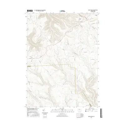
2016 Map of Snow Shoe NE
USGS Topo · Published 2016About this map
Barneys Ridge and a complex network of forest hollows define this section of the Allegheny Plateau along the Clinton and Centre County line. The landscape is carved by numerous waterways, including Fish Dam Run, Eddy Lick Run, and Big Run, reflecting the deep drainage patterns characteristic of this region. Named hollows such as Proctor Hollow, Owl Hollow, and Fetzer Hollow highlight the localized topography that historically influenced movement and land use. Primitive routes like Jews Run Rd and Bloody Skillet Rd weave through the high ground, while the inclusion of Clemson Island in the Susquehanna River's West Branch indicates the varied riverine and upland environments within this quadrangle. This 2016 survey provides a modern look at the remote access points and traditional geography of these central Pennsylvania woods.
Find a feature on this map
58 named features on this map. Tap any name to fly to it.
Don’t see what you’re looking for? This feature index may not catch every label — zoom into the map to look around manually.
Map Details
Editions of this 2016 Snow Shoe NE Map
This is the sole edition of this map. No revisions or reprints were ever made.
Other maps of this area

1921 · Howard
USGS Topo · 1:48,000

1923 · Howard
USGS Topo · 1:62,500

1928 · Snow Shoe
USGS Topo · 1:48,000

1931 · Show Shoe
USGS Topo · 1:62,500

1943 · Hyner
USGS Topo · 1:62,500

1946 · Renovo East
USGS Topo · 1:62,500

1946 · Renovo West
USGS Topo · 1:62,500

1946 · Keating
USGS Topo · 1:24,000

1946 · Renovo East
USGS Topo · 1:24,000

1946 · Renovo West
USGS Topo · 1:24,000
Featured Places
- State Camp, Noyes Township
- Burnside Township, PA
- Snow Shoe Township, PA
- Beech Creek Township, PA
- Noyes Township, PA