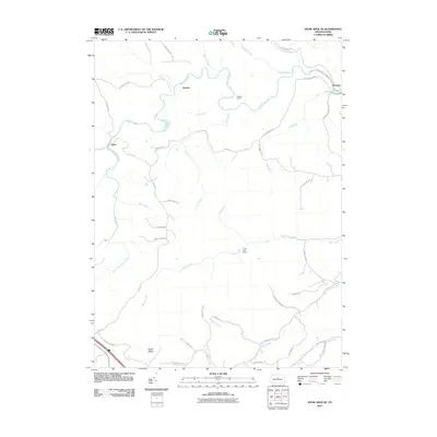
2010 Map of Snow Shoe SE
USGS Topo · Published 2010About this map
Orviston and Kato anchor the rugged drainage basins of Centre County in this 2010 topographic record, where the northern Appalachian landscape is defined by the winding paths of Beech Creek and Marsh Creek. The map documents a sparsely populated region of central Pennsylvania characterized by secluded camps and mountain runs. A significant engineering feature, the Hogback Tunnel, appears near Council Run, illustrating the historical infrastructure required to navigate these ridges. Further south, the map identifies the distinctively named Devils Elbow and Three Point Camp, providing specific points of interest for local historians and outdoorsmen. An extensive network of rural routes, including Kato Rd and Buckridge Rd, weaves through the steep topography, connecting the isolated settlement of Panther to the broader county landscape.
Find a feature on this map
45 named features on this map. Tap any name to fly to it.
Don’t see what you’re looking for? This feature index may not catch every label — zoom into the map to look around manually.
Map Details
Editions of this 2010 Snow Shoe SE Map
This is the sole edition of this map. No revisions or reprints were ever made.
Other maps of this area

1908 · Bellefonte
USGS Topo · 1:62,500

1909 · Bellefonte
USGS Topo · 1:62,500

1921 · Howard
USGS Topo · 1:48,000

1923 · Howard
USGS Topo · 1:62,500

1924 · Centre Hall
USGS Topo · 1:62,500

1928 · Snow Shoe
USGS Topo · 1:48,000

1929 · Centre Hall
USGS Topo · 1:62,500

1931 · Show Shoe
USGS Topo · 1:62,500

1943 · Lewistown
USGS Topo · 1:125,000

1950 · Harrisburg
USGS Topo · 1:250,000