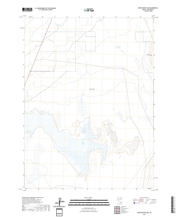
2021 Map of Snow Water Lake
USGS Topo · Published 2021About this map
Clover Valley dominates this high-desert basin in eastern Nevada, centered on the ephemeral basin of Snow Water Lake. The landscape is defined by a seasonal drainage network that feeds the central lakebed from surrounding heights like Black Ridge, with water flowing through Johnson Cr, Honeyman Cr, and Steele Cr. Human adaptation to the arid environment is evidenced by the Tobar Reservoir to the northeast and the intermittent flow of The Slough. This modern survey by the U.S. Geological Survey captures the intricate wetland patterns of Snow Water Lake and the various tributaries including Wiseman Cr and Warm Cr that sustain the local ecosystem. The map detail reflects the characteristic basin-and-range hydrology where mountain runoff terminates in lowland flats.
Find a feature on this map
16 named features on this map. Tap any name to fly to it.
Don’t see what you’re looking for? This feature index may not catch every label — zoom into the map to look around manually.
Map Details
Editions of this 2021 Snow Water Lake Map
This is the sole edition of this map. No revisions or reprints were ever made.
Other maps of this area

1935 · Halleck
USGS Topo · 1:125,000

1953 · Spruce Mountain
USGS Topo · 1:62,500

1955 · Elko
USGS Topo · 1:250,000

1958 · Elko
USGS Topo · 1:250,000

1962 · Elko
USGS Topo · 1:250,000

1965 · Elko
USGS Topo · 1:250,000

1968 · Snow Water Lake
USGS Topo · 1:24,000

1968 · Ventosa
USGS Topo · 1:24,000
1968 · Snow Water Lake NE
USGS Topo · 1:24,000
1968 · Tobar
USGS Topo · 1:24,000