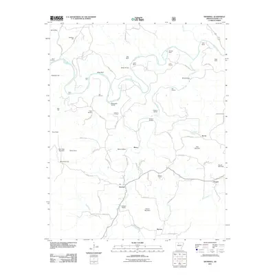
2011 Map of Snowball
USGS Topo · Published 2011About this map
The Buffalo River and Calf Creek dominate this landscape in north-central Arkansas, where narrow valleys and steep ridges dictate the placement of roads and small communities. The settlement of Snowball serves as a central point along County Hwy-12, surrounded by a network of hollows such as Blanco Hollow and Whisenant Hollow. This area is characterized by numerous small family or community burial grounds, including Slay Cemetery, Whisenant Cemetery, and McDaniel Cemetery, which provide significant value for genealogical research in Searcy County. To the northeast, the Buffalo River winds through Cash Bend and past White Bluff, while the southern terrain rises toward Granny Mountain. The map details the rural infrastructure just after the first decade of the 2000s, showing the enduring footprints of small settlements like Dongola and Marsena connected by winding county routes.
Find a feature on this map
76 named features on this map. Tap any name to fly to it.
Don’t see what you’re looking for? This feature index may not catch every label — zoom into the map to look around manually.
Map Details
Editions of this 2011 Snowball Map
This is the sole edition of this map. No revisions or reprints were ever made.
Other maps of this area

1892 · Marshall
USGS Topo · 1:125,000

1893 · Yellville
USGS Topo · 1:125,000

1894 · Marshall
USGS Topo · 1:125,000

1901 · Marshall
USGS Topo · 1:125,000

1903 · Yellville
USGS Topo · 1:125,000

1905 · Yellville
USGS Topo · 1:125,000

1929 · Yellville
USGS Topo · 1:125,000

1939 · Snowball
USGS Topo · 1:62,500

1941 · Snowball
USGS Topo · 1:62,500

1942 · Snowball
USGS Topo · 1:62,500