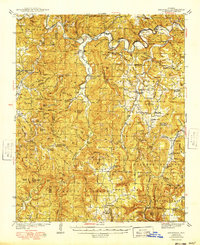
1949 Map of Snowball
USGS Topo · Published 1949About this map
The Buffalo River winds through the northern portion of this landscape, its path defined by significant elevation changes and landmarks like White Bluff and Richardson Hill. Surveyed in the late 1930s and published in the late 1940s, this area of Newton and Searcy counties shows a highly dispersed rural settlement pattern. Small community hubs such as Snowball, Witt Springs, and Marsena are connected by narrow roads that navigate the complex drainage of Richland Creek, Calf Creek, and Bear Creek.
Find a feature on this map
98 named features on this map. Tap any name to fly to it.
Don’t see what you’re looking for? This feature index may not catch every label — zoom into the map to look around manually.
Map Details
Editions of this 1949 Snowball Map
This is the sole edition of this map. No revisions or reprints were ever made.
Other maps of this area

1879 · Washington
USGS Topo · 1:62,500

1887 · Smyrna
USGS Topo · 1:62,500

1889 · Treat
USGS Topo · 1:62,500

1889 · Marshall #3
USGS Topo · 1:62,500

1892 · Marshall
USGS Topo · 1:125,000

1893 · Yellville
USGS Topo · 1:125,000

1894 · Marshall
USGS Topo · 1:125,000

1901 · Marshall
USGS Topo · 1:125,000

1903 · Yellville
USGS Topo · 1:125,000

1904 · Harrison
USGS Topo · 1:125,000