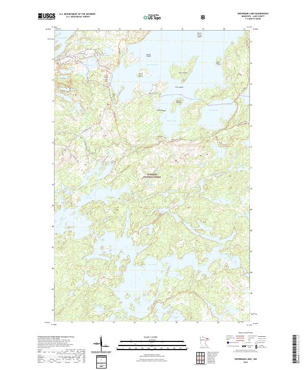
2022 Map of Snowbank Lake
USGS Topo · Published 2022About this map
Superior National Forest protects this labyrinth of glacial water and boreal forest, dominated by the sprawling expanse of Snowbank Lake. The landscape is defined by its complex shoreline and numerous islands, including Birch Island, Fire Island, and the Three Sisters Island group. Long-distance routes such as the Kekekabic Trail and the Powwow Trail provide backcountry access, intersecting with local spurs like the Becoosin Loop. The intricate drainage system of the Kawishiwi River connects Lake One and Lake Three, illustrating the interconnected nature of the Boundary Waters region. To the northwest, smaller basins such as Sommers Lake and Flash Lake sit near the terminus of Fernberg Road, where The Fernberg Tower stands as a distinct human landmark in the wilderness.
Find a feature on this map
45 named features on this map. Tap any name to fly to it.
Don’t see what you’re looking for? This feature index may not catch every label — zoom into the map to look around manually.
Map Details
Editions of this 2022 Snowbank Lake Map
This is the sole edition of this map. No revisions or reprints were ever made.
Other maps of this area

1954 · Two Harbors
USGS Topo · 1:250,000

1957 · Two Harbors
USGS Topo · 1:250,000

1957 · Gabbro Lake
USGS Topo · 1:62,500

1957 · Ensign Lake
USGS Topo · 1:62,500

1957 · Basswood Lake
USGS Topo · 1:62,500

1957 · Quetico
USGS Topo · 1:250,000

1958 · Two Harbors
USGS Topo · 1:250,000

1964 · Two Harbors
USGS Topo · 1:250,000

1968 · Quetico
USGS Topo · 1:250,000
1976 · Basswood Lake SE
USGS Topo · 1:24,000