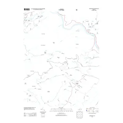
2013 Map of Snowden
USGS Topo · Published 2013About this map
The James River carves a path through the heart of this Blue Ridge landscape, defining the topography around Snowden and Greenlee. The 2013 survey illustrates a region where recreational infrastructure and natural landmarks converge, featuring the James River Valley Overlook and the Thunder Ridge Overlook along the Blue Ridge Pkwy. To the south, Terrapin Mountain and Goff Mountain overlook rural residential developments near Powells Store, where roads like Powell School Rd and Panorama Acres Rd indicate local settlement patterns. Significant natural features including Devils Marbleyard and Highcock Knob stand as prominent landmarks for hikers, supported by backcountry waypoints like the Johns Hollow Shelter and Marble Spring Shelter. The map also captures the local network of creeks, such as Hunting Cr and Battery Cr, which drain the ridges and hollows that have shaped the area's geography for generations.
Find a feature on this map
96 named features on this map. Tap any name to fly to it.
Don’t see what you’re looking for? This feature index may not catch every label — zoom into the map to look around manually.
Map Details
Editions of this 2013 Snowden Map
This is the sole edition of this map. No revisions or reprints were ever made.
Other maps of this area

1890 · Roanoke
USGS Topo · 1:125,000

1891 · Roanoke
USGS Topo · 1:125,000

1892 · Lynchburg
USGS Topo · 1:125,000

1894 · Natural Bridge
USGS Topo · 1:125,000

1894 · Lexington
USGS Topo · 1:125,000

1894 · Natural Bridge
USGS Topo · 1:62,500

1907 · Natural Bridge Special
USGS Topo · 1:62,500

1935 · Buena Vista
USGS Topo · 1:48,000

1939 · Buena Vista
USGS Topo · 1:62,500

1940 · Buena Vista
USGS Topo · 1:62,500