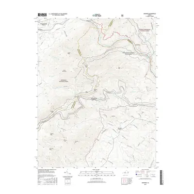
2016 Map of Snowden
USGS Topo · Published 2016About this map
The James River cuts a deep and winding path through the Blue Ridge Mountains on this 2016 survey, forming a natural corridor for both historic industry and modern recreation. In the northern reaches, the town of Glasgow and the community of Natural Bridge Station sit near the confluence of several mountain creeks, while the settlement of Snowden occupies a strategic bend in the river further east. This landscape is defined by its steep elevation changes, ranging from the depths of Cushaw Reservoir to the heights of Thunder Ridge and Highcock Knob. The mapping documents the convergence of two major federal lands, the Jefferson National Forest and George Washington National Forest, intersected by the iconic Appalachian National Scenic Trail and the Blue Ridge Parkway. Local history is preserved in sites like the Sharon Cem and Tolley Cem, while unusual geological features such as the Devils Marbleyard highlight the area's distinctive mountain terrain.
Find a feature on this map
75 named features on this map. Tap any name to fly to it.
Don’t see what you’re looking for? This feature index may not catch every label — zoom into the map to look around manually.
Map Details
Editions of this 2016 Snowden Map
This is the sole edition of this map. No revisions or reprints were ever made.
Other maps of this area

1890 · Roanoke
USGS Topo · 1:125,000

1891 · Roanoke
USGS Topo · 1:125,000

1892 · Lynchburg
USGS Topo · 1:125,000

1894 · Natural Bridge
USGS Topo · 1:125,000

1894 · Lexington
USGS Topo · 1:125,000

1894 · Natural Bridge
USGS Topo · 1:62,500

1907 · Natural Bridge Special
USGS Topo · 1:62,500

1935 · Buena Vista
USGS Topo · 1:48,000

1939 · Buena Vista
USGS Topo · 1:62,500

1940 · Buena Vista
USGS Topo · 1:62,500