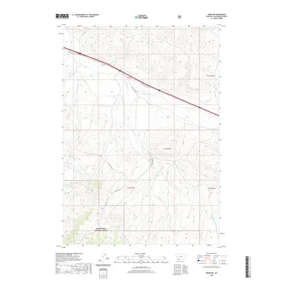
2020 Map of Snowline
USGS Topo · Published 2020About this map
Beaverhead National Forest land dominates the southern portion of this high-elevation landscape, where numerous drainage systems converge. The settlement of Snowline serves as a central point along the northern corridor, positioned where the Snowline Stock Ln traverses the terrain. This area is defined by a dense network of mountain streams, including Junction Cr and Big Beaver Cr, which carve through the topography toward the surrounding valleys. To the east, Diamond Butte provides a prominent landmark overlooking the headwaters of Poison Cr. Historical access routes such as Sawmill Creek Rd and Shineberger Rd indicate a long-standing reliance on these corridors for forest management and livestock movement. The mapping of specific creek branches like W Fork Big Beaver Cr and Shineberger Cr highlights the intricate hydrology that has shaped land use in this part of Beaverhead County.
Find a feature on this map
23 named features on this map. Tap any name to fly to it.
Don’t see what you’re looking for? This feature index may not catch every label — zoom into the map to look around manually.
Map Details
Editions of this 2020 Snowline Map
This is the sole edition of this map. No revisions or reprints were ever made.
Other maps of this area

1955 · Dubois
USGS Topo · 1:250,000

1957 · Paul Reservoir
USGS Topo · 1:62,500

1957 · Edie Ranch
USGS Topo · 1:62,500

1958 · Dubois
USGS Topo · 1:250,000

1965 · Lima
USGS Topo · 1:24,000

1965 · Lima Peaks
USGS Topo · 1:24,000

1968 · Lima Dam
USGS Topo · 1:24,000

1968 · Snowline
USGS Topo · 1:24,000

1968 · Monida
USGS Topo · 1:24,000

1968 · Henry Gulch
USGS Topo · 1:24,000