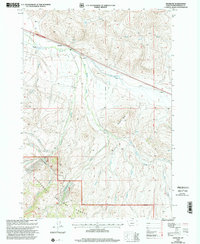
1997 Map of Snowline
USGS Topo · Published 2002About this map
Snowline Ranch occupies a prominent position in this high-altitude landscape of southwestern Montana, where the headwaters of numerous creeks begin their descent from the high ridges. The area is defined by the Continental Divide, which snakes across the southern portion of the sheet, followed closely by the Continental Divide Scenic Trail. This drainage basin feeds a complex network of waterways, including Big Beaver Creek, Shineberger Creek, and Poison Creek, illustrating the vital role of this terrain in the regional watershed. Evidence of mountain industry and infrastructure is visible through the presence of Gravel Pits and a Drill Hole located near the ranch. The vast majority of the southern map area is protected within the Beaverhead National Forest, characterized by the prominent elevation of Diamond Butte.
Find a feature on this map
24 named features on this map. Tap any name to fly to it.
Don’t see what you’re looking for? This feature index may not catch every label — zoom into the map to look around manually.
Map Details
Editions of this 1997 Snowline Map
This is the sole edition of this map. No revisions or reprints were ever made.
Other maps of this area

1955 · Dubois
USGS Topo · 1:250,000

1957 · Paul Reservoir
USGS Topo · 1:62,500

1957 · Edie Ranch
USGS Topo · 1:62,500

1958 · Dubois
USGS Topo · 1:250,000

1965 · Lima
USGS Topo · 1:24,000

1965 · Lima Peaks
USGS Topo · 1:24,000

1968 · Lima Dam
USGS Topo · 1:24,000

1968 · Snowline
USGS Topo · 1:24,000

1968 · Monida
USGS Topo · 1:24,000

1968 · Henry Gulch
USGS Topo · 1:24,000