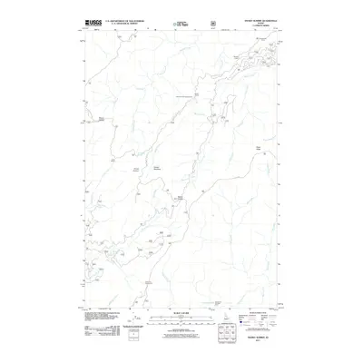
2011 Map of Snowy Summit
USGS Topo · Published 2011About this map
The Lolo Trl winds across this portion of Idaho County, marking a historic transportation corridor through the Clearwater National Forest area. This 2011 survey focuses on the high-elevation backcountry, where the landscape is defined by the drainages of Hungery Creek, Yoosa Creek, and Middle Creek. The map documents a network of Forest Service infrastructure, including numerous backcountry stations such as Nineteenmile Camp, Savage Camp, and Camp Martin.
Find a feature on this map
36 named features on this map. Tap any name to fly to it.
Don’t see what you’re looking for? This feature index may not catch every label — zoom into the map to look around manually.
Map Details
Editions of this 2011 Snowy Summit Map
This is the sole edition of this map. No revisions or reprints were ever made.
Other maps of this area

1911 · Lolo
USGS Topo · 1:250,000

1913 · Lolo
USGS Topo · 1:250,000

1923 · Washington Creek
USGS Topo · 1:125,000

1924 · Weippe
USGS Topo · 1:125,000

1956 · Hamilton
USGS Topo · 1:250,000

1959 · Hamilton
USGS Topo · 1:250,000

1960 · Hamilton
USGS Topo · 1:250,000

1964 · Hamilton
USGS Topo · 1:250,000

1965 · Lean-to Point
USGS Topo · 1:24,000
1965 · Larch Butte
USGS Topo · 1:24,000