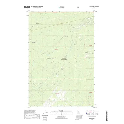
2020 Map of Snowy Summit
USGS Topo · Published 2020About this map
Clearwater National Forest spans the divide between Clearwater and Idaho counties, characterized by a series of prominent ridges and high-altitude saddles. The historic Lolo Trl traverses the eastern edge of the quadrangle, passing near Rocky Ridge and Obia Cr, tracing a path used for centuries across the Bitterroot Mountains. In the heart of the forest, Soldier Meadows and Squawberry Spring provide rare level openings amidst the steep drainages of Middle Cr and Hemlock Cr. The landscape is a complex network of forest development roads, including Nat For Dev Rd 103 and Nat For Dev Rd 555, which navigate the steep elevations between Snowy Summit and Austin Ridge. This map documents the essential topography and drainage systems, such as Eldorado Cr and Hungery Cr, that define this backcountry region.
Find a feature on this map
48 named features on this map. Tap any name to fly to it.
Don’t see what you’re looking for? This feature index may not catch every label — zoom into the map to look around manually.
Map Details
Editions of this 2020 Snowy Summit Map
This is the sole edition of this map. No revisions or reprints were ever made.
Other maps of this area

1911 · Lolo
USGS Topo · 1:250,000

1913 · Lolo
USGS Topo · 1:250,000

1923 · Washington Creek
USGS Topo · 1:125,000

1924 · Weippe
USGS Topo · 1:125,000

1956 · Hamilton
USGS Topo · 1:250,000

1959 · Hamilton
USGS Topo · 1:250,000

1960 · Hamilton
USGS Topo · 1:250,000

1964 · Hamilton
USGS Topo · 1:250,000

1965 · Lean-to Point
USGS Topo · 1:24,000
1965 · Larch Butte
USGS Topo · 1:24,000