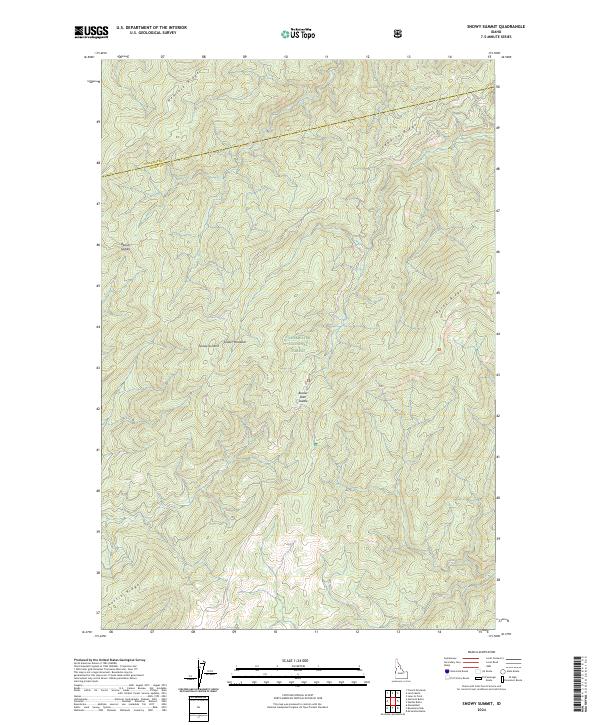
2024 Map of Snowy Summit
USGS Topo · Published 2024About this map
Snowy Summit stands as a prominent high point in this remote corner of the Clearwater National Forest, marking a landscape defined by an intricate network of high ridges and narrow saddles. The terrain is structured by a series of significant elevations including Hemlock Ridge to the north and Austin Ridge at the southern boundary. This 2024 survey captures the topographical complexity of the Bitterroot backcountry where Idaho and Clearwater counties meet. The presence of Soldier Meadows and Lean-To-Spring suggests isolated points of relief within the dense forest canopy, while natural transit corridors are indicated by labels like Beaver Dam Saddle and Beaver Saddle. The mapping of these features, alongside the sharp relief of Rocky Ridge, provides a contemporary record of this undeveloped wilderness area.
Find a feature on this map
17 named features on this map. Tap any name to fly to it.
Don’t see what you’re looking for? This feature index may not catch every label — zoom into the map to look around manually.
Map Details
Editions of this 2024 Snowy Summit Map
This is the sole edition of this map. No revisions or reprints were ever made.
Other maps of this area

1911 · Lolo
USGS Topo · 1:250,000

1913 · Lolo
USGS Topo · 1:250,000

1923 · Washington Creek
USGS Topo · 1:125,000

1924 · Weippe
USGS Topo · 1:125,000

1956 · Hamilton
USGS Topo · 1:250,000

1959 · Hamilton
USGS Topo · 1:250,000

1960 · Hamilton
USGS Topo · 1:250,000

1964 · Hamilton
USGS Topo · 1:250,000

1965 · Lean-to Point
USGS Topo · 1:24,000
1965 · Larch Butte
USGS Topo · 1:24,000