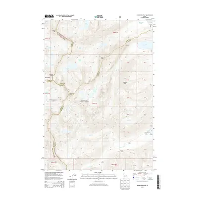
2013 Map of Snowyside Peak
USGS Topo · Published 2013About this map
Snowyside Peak and the high basins of the Sawtooth National Forest dominate this 2013 topographical study of the Idaho backcountry. This map captures a complex intersection of county boundaries, where Elmore, Boise, Custer, and Blaine counties meet among the granite summits. The landscape is defined by an intricate network of glacial lakes, including Toxaway Lake, Alice Lake, and Edna Lake, which feed the upper reaches of the S Fork Payette River. The concentration of high-altitude water bodies like Imogene Lake and Pettit Lake highlights the hydrology of the Sawtooth Range during the early 21st century. Human activity is largely confined to recreation at the Alturas Inlet Campground near the shores of Alturas Lake, while the interior remains a roadless expanse of named peaks like El Capitan and McDonald Peak. This record is essential for tracing the geography of the Boise and Sawtooth National Forests before more recent environmental changes.
Find a feature on this map
45 named features on this map. Tap any name to fly to it.
Don’t see what you’re looking for? This feature index may not catch every label — zoom into the map to look around manually.
Map Details
Editions of this 2013 Snowyside Peak Map
This is the sole edition of this map. No revisions or reprints were ever made.
Other maps of this area

1891 · Bear Valley
USGS Topo · 1:125,000

1893 · Bear Valley
USGS Topo · 1:125,000

1894 · Rocky Bar
USGS Topo · 1:125,000

1900 · Sawtooth
USGS Topo · 1:125,000

1919 · Custer
USGS Topo · 1:125,000

1922 · Custer
USGS Topo · 1:125,000

1955 · Hailey
USGS Topo · 1:250,000

1957 · Challis
USGS Topo · 1:250,000

1959 · Hailey
USGS Topo · 1:250,000

1960 · Challis
USGS Topo · 1:250,000