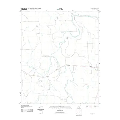
2011 Map of Snyder
USGS Topo · Published 2011About this map
Bayou Bartholomew meanders through this portion of Ashley County, its intricate oxbows and bends defining a landscape deeply tied to the alluvial drainage of southeastern Arkansas. The settlement of Snyder sits at the western edge of the quadrangle, while the rail-aligned hamlets of Thebes, Donbey, and Lloyd follow the corridor of Hwy-160 and the railroad. This network of small stations and spurs, including Owens Spur, illustrates the historic importance of regional transport for the surrounding timber and agricultural lands.
Find a feature on this map
48 named features on this map. Tap any name to fly to it.
Don’t see what you’re looking for? This feature index may not catch every label — zoom into the map to look around manually.
Map Details
Editions of this 2011 Snyder Map
This is the sole edition of this map. No revisions or reprints were ever made.
Other maps of this area

1935 · Mist
USGS Topo · 1:62,500

1935 · Wilmot
USGS Topo · 1:62,500

1936 · Eudora
USGS Topo · 1:62,500

1936 · Lake Village
USGS Topo · 1:62,500

1953 · Greenwood
USGS Topo · 1:250,000

1955 · Lake Village
USGS Topo · 1:62,500

1956 · Greenwood
USGS Topo · 1:250,000

1957 · Eudora
USGS Topo · 1:62,500

1960 · Snyder
USGS Topo · 1:24,000

1960 · Mist
USGS Topo · 1:62,500