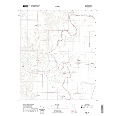
2020 Map of Snyder
USGS Topo · Published 2020About this map
Bayou Bartholomew winds significantly through this section of Ashley County, defining a landscape of wetlands and oxbow lakes. The drainage pattern is marked by numerous brakes and sloughs, including Simpson Brake, Holloway Brake, and Perkins Slough, which characterize the low-lying alluvial terrain. The eastern edge of the survey features the town of Montrose, while the western portion includes the settlements of Snyder, Thebes, and Trafalgar. Transportation throughout the area is a mix of state routes and numbered county roads, such as Hwy 278 and Ashley Road 60. The map illustrates a clear division between the more elevated ground to the west, where Bearhouse Creek and Caney Cr flow, and the densely saturated wetlands of the bayou basin where features like Lake Grampus and Lloyds Bayou are situated.
Find a feature on this map
48 named features on this map. Tap any name to fly to it.
Don’t see what you’re looking for? This feature index may not catch every label — zoom into the map to look around manually.
Map Details
Editions of this 2020 Snyder Map
This is the sole edition of this map. No revisions or reprints were ever made.
Other maps of this area

1935 · Mist
USGS Topo · 1:62,500

1935 · Wilmot
USGS Topo · 1:62,500

1936 · Eudora
USGS Topo · 1:62,500

1936 · Lake Village
USGS Topo · 1:62,500

1953 · Greenwood
USGS Topo · 1:250,000

1955 · Lake Village
USGS Topo · 1:62,500

1956 · Greenwood
USGS Topo · 1:250,000

1957 · Eudora
USGS Topo · 1:62,500

1960 · Snyder
USGS Topo · 1:24,000

1960 · Mist
USGS Topo · 1:62,500